Maps & locations
MW4 Hajin Map: 13 POIs, Threats & Key Grids
Use the official map and POI directory to plan DMZ travel, then read key coordinates and current extraction markers.
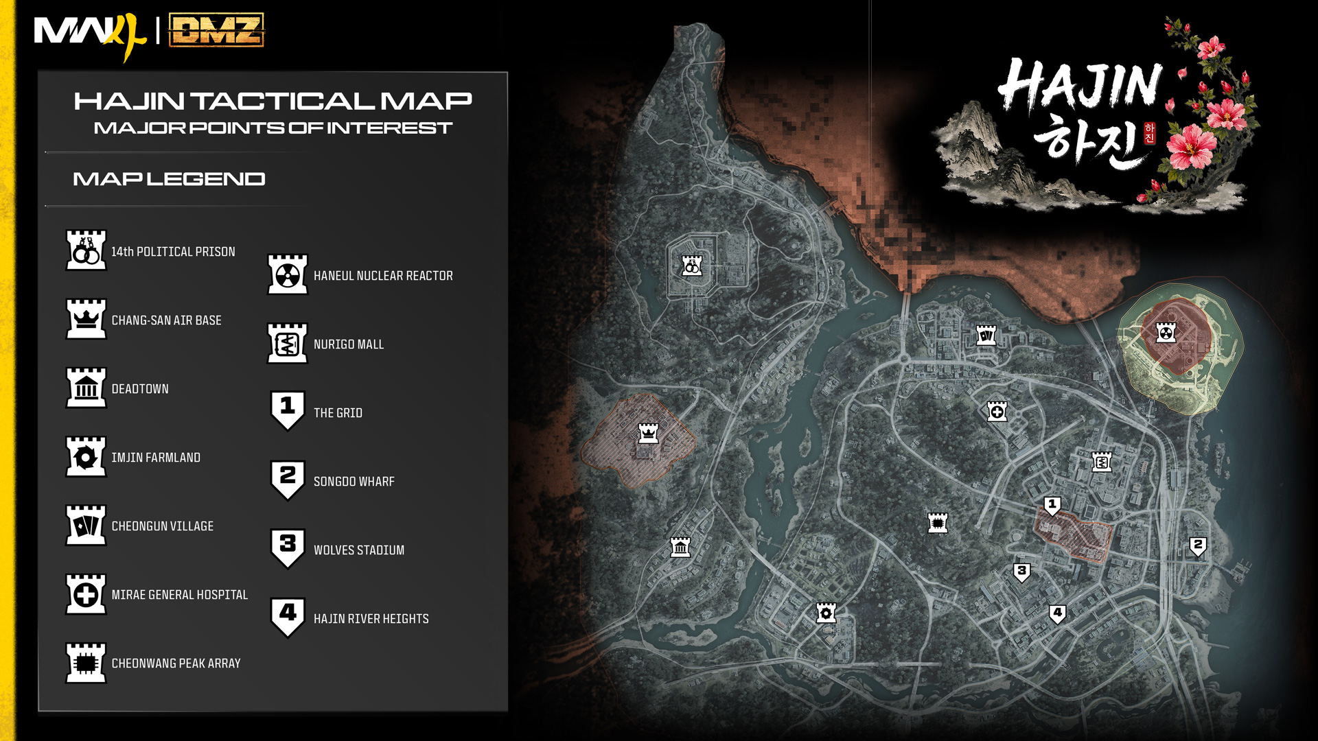
Read the map first
The official Hajin overview divides the region into 13 major POIs. The map image above is official promotional material. Threat labels describe expected areas, not a guarantee of an empty route or fixed enemy spawn. The Grid and Chang-san Air Base include the highest reported threat labels; quieter exterior areas can still contain players.
POI directory
Wide tables can be scrolled sideways.
| POI | General position | Announced threat |
|---|---|---|
| 14th Political Prison | Northwest | High–Critical |
| Chang-san Air Base | West | Critical–Extreme |
| Deadtown | Southwest | Low–Medium |
| Imjin Farmland | South-southwest | Low–Medium |
| Cheongun Village | North | Low; casino High |
| Mirae General Hospital | North-central | Low |
| Cheonwang Peak Array | Central | Medium |
| Haneul Nuclear Reactor | Northeast | High; radiation |
| NuriGO Mall | Northeast city | Medium–High |
| The Grid | Central city | Critical–Extreme |
| Songdo Wharf | Eastern city | Low |
| Wolves Stadium | South-central city | Medium |
| Hajin River Heights | Southeast | Medium |
Keys and extraction
Read the key’s description and grid before moving. Letters run west to east; numbers run north to south. The official example D7 refers to Imjin Farmland. Follow the active green-smoke extraction marker for the current match rather than a static list from another run. Read keys and DMZ basics before committing valuable gear.
Sources & version
Source review: October 22, 2026. Official Hajin overview